Paulo Murillo
Satellite and aerial remote sensing allow us to monitor diverse phenomena on Earth surface. I use dense remote sensing time-series to evaluate and capture changes on landscape associated to the complex co-evolution of natural and social systems. Using different change detection analysis, I am interested in the monitoring of agriculture systems, forest transitions. mangroves and their connection with socio-environmental issues such as armed conflict and institutional frameworks. Google Scholar
Experience
Assistant professor
Courses taught: Cartography - GIS and remote sensing.
Postdoctoral associate
Mapping mangroves historical transformation using optical and radar data.
Remote sensing Analyst
Using remote sensing time-series for crop monitoring. Estimation of biophysical parameters in sugarcane using aerial cameras and a field spectrometer.
Research assistant
Characterization of soils and sugarcane using remote sensing. Development of soils spectral library and mineralogical composition of soils using NIRS. Simulations of sugarcane spectral signatures using PROSPECT+SAIL
Education
Oregon State University
Oregon State University
Universidad del Valle
Skills
GIS
Remote sensing
Languages
Publications
Articles
2026. Alvear Natalia, Ramirez Joaquin, Murillo-Sandoval Paulo. Assessing two decades (2000–2020) of agricultural and mining-driven land-cover change through spatial analysis and social perceptions in Sonsón, Antioquia, Colombia. Environmental Monitoring and Assessment. v198, 2932025. KMA Islam, Murillo-Sandoval Paulo,Bullock Eric, and Kennedy Robert. Accelerated Adoption of Google Earth Engine for Mangrove Monitoring: A Global Review Remote Sensing 17 (13), 2290
2025. Murillo-Sandoval Paulo, Perea-Ardila Mauricio and Simard Marc. Examining the status of mangrove forest dynamics and community-led management on the Colombian Pacific coast. Ocean & Coastal Management. 266, 107672
2024. Murillo-Sandoval Paulo, Sesnie Steven...McSweeney Kendra. Central America's agro-ecological suitability for cultivating coca, Erythroxylum spp. Environmental Research Letters. v19, No 10
2024. Anne Bartlett, Jennifer Alix-Garcia, Alejandro Abarca, Sarah Walker, Jamon Van Den Hoek, Paulo J Murillo-Sandoval, Hannah Friedrich. The unintended consequences of production bans: the case of the 2018 Kenya logging moratorium. Environmental Research Letters. V19, No 9
2024. Jesica J López, Y Qian,Murillo-Sandoval Paulo J, Clerici Nicola, Eklundh Lars Landscape connectivity loss after the de-escalation of armed conflict in the Colombian Amazon (2011-2021). Global Ecology and Conservation. v54
2024. Fernando Mendez, Murillo-Sandoval Paulo J and Itzvan Valánszki. The unidirectional relationship between forest disturbance and armed conflict in the Andean Paramo. Trees, forest and People. v17
2024. Perea-Ardila Mauricio, Murillo-Sandoval Paulo J. Comparación de índices de vegetación basados en imágenes satelitales para la identificación de bosques de manglar en Colombia. Madera y Bosques.
2024. Erazo-Mesa Edwin, Murillo-Sandoval Paulo J. , Ramírez-Gil Joaquín Guillermo , Quiroga Benavides Kevin & Echeverri Sánchez Andrés. IS-SAR: an irrigation scheduling web application for Hass avocado orchards based on Sentinel-1 images. Irrigation Science.
2023. Baltezar Priscilla , Murillo-Sandoval Paulo J, ....Marc Simard, Temilola Fatoyinbo. A regional map of mangrove extent for Myanmar, Thailand, and Cambodia shows losses of 44% by 1996. Frontiers in Marine Science, v10.
2023. de Sousa Celio, Lola Fatoyinbo, ... Murillo-Sandoval Paulo J. Two decades of land cover change and forest fragmentation in Liberia: Consequences for the contribution of nature to people. Conservation Science and Practice.
2023. Murillo-Sandoval Paulo J. Disentangling the landscape during armed conflicts and postpeace agreements: Clues from Colombia's Andes-Amazon region. Integrated Environmental Assessment and Management, v19.
2023. Murillo-Sandoval Paulo J., Kilbride John, Tellman Elizabeth, Wrathall David, Van Den Hoek Jamon and Kennedy Robert .The post-conflict expansion of coca farming and illicit cattle ranching in Colombia. Scientific Reports Nature, v13.
2023. Walker Sarah, Alix-Garcia Jennifer, Bartlett Anne, Van Den Hoek Jamon, Friedrich Hannah, Murillo-Sandoval Paulo J , Isoto Rosemary. Overlapping Land Rights and Deforestation in Uganda: 20 Years of Evidence. Global Environmental Change, v82.
2022. Murillo-Sandoval Paulo J, Nicola Clerici, Camilo Correa-Ayram. Rapid loss in landscape connectivity after the peace agreement in the Andes-Amazon region. Ecosistemas, v38.
2022. Perea-Ardila Mauricio y Murillo-Sandoval Paulo J. La ganancia de manglar y sus implicaciones en el reservorio de Carbono del Parque Nacional Natural Sanquianga en Colombia. Ecosistemas, v31.
2022. Murillo-Sandoval Paulo J, Fatoyinbo Lola and Simard Marc. Mangroves cover change trajectories 1984-2020: The gradual decrease of mangroves in Colombia. Frontiers in Marine Science1, v9.
2021. Michael Alonzo, V...Murillo-Sandoval Paulo J... Zinda John Aloysius. Mapping and quantifying land cover dynamics using dense remote sensing time series with the user-friendly pyNITA software. Environmental Modelling & Software, v145.
2021. Treviño Melva and Murillo-Sandoval, P.J. Uneven consequences: Gendered impacts of shrimp aquaculture development on mangrove dependent communities. Ocean & Coastal Management, v210
2021. Murillo-Sandoval, P.J, Gjerdseth E., Correa-Ayram, C., Wrathall D., Van Den Hoek J. Davalos L., and Kennedy, R. No peace for the forest: Rapid, widespread land changes in the Andes-Amazon region following the Colombian civil war. Global Environmental Change, v69.
2020. Murillo-Sandoval, P.J, Van Dexter, Kristina, Van Den Hoek, Jamon, Wrathall, David and Kennedy, Robert E. The end of gunpoint conservation: forest disturbance after the Colombian peace agreement. Environmental Research Letters,2020,15,3.
2018. Murillo-Sandoval, P.J, Hilker, T., Krawchuk, M.A and Van Den Hoek, J. Detecting and Attributing Drivers of Forest Disturbance in the Colombian Andes Using Landsat Time-Series. Forests 2018, 9, 269.
2017. Murillo-Sandoval, P.J, Van Den Hoek, J. and Hilker, T. Leveraging Multi-Sensor Time Series Datasets to Map Short- and Long-Term Tropical Forest Disturbances in the Colombian Andes. Remote Sens. 2017, 9, 179.
2011. Murillo-Sandoval, P.J, Carbonell J.A, Osorio C. A. Evaluation of Landsat 7 ETM+ data for spectral discrimination and classification of sugarcane varieties in Colombia. Journal of Agricultural Science and Technology B1, (2011) 101-107. ISSN 1939-1250.
Books and book chapters
2025. Camilo Correa-Ayram, Oscar Godínez-Gómez, Paulo Murillo-Sandoval."Forest Connectivity Loss Surpasses Deforestation in the Colombian Andean Forests". In Conservation of Andean Forests. ISBN: ed: SPRINGER,2023. Murillo-Sandoval, P.J."Coca, cattle and the Forest. The expansion of coca farming and illicit cattle ranching in Colombia". In Cartographies of Drugs and Spaces. ISBN: 978-3-98612-000-9. ed: JOVIS , Germany.
2012. Murillo-Sandoval, P.J, Carbonell-González, J.A. 2012. Principios y aplicaciones de la percepción remota en el cultivo de la caña de azúcar en Colombia. Cali : CENICAÑA, 181p.
Proceedings
2010. Murillo P. J., Carbonell J. A., Osorio C. A., PALMA A. E. Monitoring sugarcane crops in the Cauca river valley (Colombia), using modis satellite images. Proc. Int. Soc. Sugar cane technol., vol. 27, 2010.2009. Murillo-Sandoval P. J., Carbonell J. A., Osorio C. A., PALMA A. E. Estimación temprana de producción de caña de azúcar a partir de imágenes satelitales MODIS En: Congreso TECNICAÑA (Colombian Association of Sugar Cane Technicians). 16-18 September de 2009. Cali-(Valle).
2008. Murillo-Sandoval P. J., Osorio C. A. y Carbonell J. A. Análisis de series de tiempo MODIS para el seguimiento del cultivo de la caña de azúcar en el valle del río Cauca. En: XI Congreso nacional de ingenieros agrícolas y áreas relacionadas 2008: Medellín (Colombia).
2007. Murillo-Sandoval P. J., Carbonell J. A., Osorio C. A., BASTIDAS-OBANDO E. Discrimination of sugarcane varieties CC 85-92 and CC 84-75 using Landsat 7 ETM+ satellite imagery. In: Proc. Int. Soc Sugar Cane Technol., Vol 26, 2007.
2006. Murillo-Sandoval, P.J.; Carbonell González, J.; Osorio, C.A. 2006. “Estado del arte en el uso de la percepción remota en la caña de azúcar” En: Congreso TECNICAÑA (Colombian Association of Sugar Cane Technicians). 6-8 September de 2006. Cali-(Valle).
2006. Carbonell González, J.; Bastidas Obando, E.; Murillo Sandoval, P.J. 2006. Aplicaciones recientes de la percepción remota en la agroindustria colombiana. En: Carta trimestral CENICAÑA (Colombia) v.28 nos.3-4, Jul.-Dic. (2006) p.19-22.
Conferences
2026.El seguimiento a las dinámicas preinvasivas: la expansión de especies introducidas en la ciénega grande de santa marta. Senalmar. Colombia-Medellin. Mayo 5 al 8 de 20262025.Camilo A Correa-Ayram, Oscar Godínez-Gómez,Paulo J Murillo-Sandoval y Diego Barragán-Montenegro. Pérdida multiescalar de conectividad ecológica en los bosques andinos colombianos entre 1985 y 2022. Congreso Nacional de Ecologia. Cali. Spe 2 al 5 de 2025
2024. Kendra McSweeney,Paulo J Murillo Sandoval, Steven Sesnie,Manuel Ordonez, Nicholas Magliocca, , Beth Tellman, Jennifer Devine, Erik Nielsen. Is Central America Agro-ecologically Suitable for Growing Coca (Erythroxylum Spp)?. Global Land Program, Oaxaca, Mexico, November4-8, 2024.
2024. ¿Alguien quiere pensar en la naturaleza? ¿Qué prima: los derechos humanos o los derechos de la naturaleza?. Filbo2024, Bogotá April 30, 2024.
2023. Mapping coca from space: Coca dynamics during and after the Colombian armed conflict. The hAmerican Geophysical Union (AGU).San Francisco. Dec 11, 2023.
2022. Segunda cumbre de Inteligencia Artificial Colombia: Sostenibilidad y Cambio Climático. Bogotá, Sep 28.
2019. Murillo P. J., Van Dexter K.,Van Den Hoek J. and Kennedy R. The Immediate Impact of the Colombian Peace Agreement on Forest Conversion. American Association of Geographers (AAG), Washington D.C, April 3 -6.
2019. Ballasiotes, A. D.; Van Den Hoek, J.; Friedrich, H.; Murillo-Sandoval, P.; Roberts-Pierel, B. American Geophysical Union. Earth Observations to assess SDG 16: monitoring terrestrial and coastal signals of conflict in Gaza via satellite imagery San Francisco-CA, Fall 2019.
2018. Van Den Hoek, J.; Murillo-Sandoval, P.; Crumley, R. L.; Devenish, A.; Fein, F.; Kennedy, R. E.; Ichien, S.; Wrathall, D.; Harris, T. American Geophysical Union.Refugee Camps as Climate Traps: Measuring the Enviro-climatic Marginality of 922 Global Refugee Camps with Satellite Time Series Data San Francisco-CA, Fall 2018.
2018. Murillo P. J., Kennedy R. and Van Den Hoek J. A global assessment of the impact of armed conflict on forests using Google Earth Engine. American Association of Geographers (AAG), New Orleans-LA, April 9 -14.
2016. Murillo P. J. and Hilker T. Forest monitoring using remote sensing time-series: The case of Colombian Andes Protected Areas. ForestSat2016, Santiago de Chile, Nov 14-16.
2015. Murillo P. J. and Hilker T. Forest monitoring in the Andes Mountain using MAIAC time-series. BIOCON, Lima-Peru, October 15 – 18.
2013. Remote sensing and field spectroradiometry to monitoring of crops. International engineering seminary IES UNISANGIL 2013, SanGil - Colombia. September 17-21.
2012. VIIIth Congreso de la Asociación de técnicos azucareros de Latinoamerica y el Caribe (ATALAC). 12 -14 Septiembre. Estimación de contenidos de clorofila a nivel de follaje en caña de azúcar por medio de datos hiperespectrales.
2012.. Seminario Agricultura Específica por Sitio y Agricultura de Precisión. 28-30 septiembre. TECNICAÑA. Aplicaciones de la percepción remota en Cenicaña.
2009. VIIIth Congreso de TECNICAÑA (Técnicos de la caña de azúcar de Colombia). 16-18 septiembre. Cali-(Valle). Análisis preliminar para la identificación de variedades de caña de azúcar en áreas diferentes al valle del río Cauca, usando imágenes Landsat 7 ETM+.
2009. VIIIth Congreso de TECNICAÑA (Técnicos de la caña de azúcar de Colombia). 16-18 septiembre de 2009. Cali-(Valle). Estimación temprana de producción de caña de azúcar a partir de imágenes satelitales MODIS.
2006. VIIth Congreso de TECNICAÑA (Técnicos de la caña de azúcar de Colombia). 6-8 septiembre de 2006. Cali-(Valle). Estado del arte en el uso de lapercepción remota en la caña de azúcar.
2006. VIIth Congreso de TECNICAÑA (Técnicos de la caña de azúcar de Colombia). 6-8 septiembre de 2006. Cali-(Valle).” Clasificación de las variedades CC 85-92 y CC 84-75 usando datos satelitales Landsat 7 ETM+.
Social Work
Reconstrucción urbana de Armero 2023. Realizar la localización de las principales vías urbanas de Armero a partir una fotografía área tomada en el año 1985 (antes de la tragedia) vs. ortofoto del año 2008. El proposito radica en conocer la movilidad del tejido urbano despues de la avalancha para el proceso de reconstruccion historica. Este trabajo contribuyó a la reconstrucción de la memoria histórica del municipio de Armero, ayudando a los sobrevivientes de este desastre, a sus familiares y a toda la nación colombiana para propender por la mitigación de los riesgos de origen natural.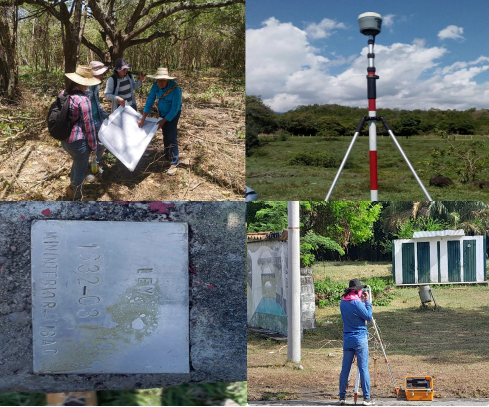 Imagenes del proceso Topográfico adelantado en Armero
Curso auxiliares de topografia Institucion Educativa La aguadita, Fresno Tolima, 2023. Diseñar una estrategia de capacitación para la formación de auxiliares en en el uso de la topografía.
Estudio Topográfico Del Asentamiento Urbano Ucrania En El Municipio De Ibagué-Tolima, 2023. La informacion suministrada permite una eventual legalizacion de los lotes que han sido ocupados con el propósito de crear alternativas que garanticen la dignidad de las personas que habitan en el sector.
Projects & awards
- Bridging Legal and Ecological Perspectives: Remote Sensing Embedding Fields for Tracking Mining Expansion in Post-conflict Societies.Amount: 5000USD. 2026-2027.
- Implementación de series temporales multi-sensor para el mapeo de la cobertura de manglar y sus motores de cambio en el Pacífico Chocoano. Amount: 40000USD. 2023-2024.
- Egresado distinguido de la Universidad del Valle - Noviembre de 2022.
- Seguimiento al bosque urbano: Reconstrucción tridimensional de la altura del bosque en el Jardín Botánico Alejandro Von Humboldt usando percepción remota. .Amount: 5000USD. 2023-2024.
- International cultural service program (ISCP) scholarship. Oregon State University. Amount: 45000USD. 2016-2019.
- University Graduate Laurels Scholarship. College of Forestry. Oregon State University. Amount: $13243USD. Semester A-2016.
- Generation of a spectral database, Study Area: Botanic Garden Alejandro Von-Humboldt (Universidad del Tolima). Funding code: 300114. Universidad del Tolima http://www.ut.edu.co/. Amount: $10000USD. 2014-2015.
- Monitoring of sugarcane crop using remote sensing data, Funding code: 221440520288, COLCIENCIAS–COLOMBIA http://www.colciencias.gov.co/. Amount: $78000USD. 2008-2010.